Seequent unveils SLOPE3D: Advanced stability analysis tool to help engineers design safer slopes

SLOPE3D extends capabilities of GeoStudio’s trusted 2D SLOPE/W product into 3D, significantly enhancing stability assessments for slopes in the mining and civil industries.

Seequent, The Bentley Subsurface Company, announced the release of SLOPE3D, an advanced slope stability analysis tool that empowers geotechnical engineers and engineering geologists to design safer slopes.

Building on the capabilities of GeoStudio’s trusted 2D SLOPE/W product, SLOPE3D is an intuitive limit equilibrium solution for analyzing rock and soil slopes in mining and civil projects – for example, hillslopes, open pit mines, and engineered structures such as dams and levees.

Chris Kelln, Director, Technical Solutions for GeoStudio, said, “SLOPE3D combines the most up-to-date research on 3D slope analysis techniques with the capabilities in SLOPE/W, a trusted tool for assessing 2D slope stability for over 30 years, providing a practical approach for capturing slope failure mechanisms for simple to complex geotechnical models.”

“Ensuring the safety and reliability of engineered projects is at the heart of geotechnical engineering,” Kelln added. “We specifically designed SLOPE3D to empower geotechnical and geological engineers to make confident decisions, improve safety, reduce project risks and costs, and ultimately design better infrastructure.”

GeoStudio’s powerful and easy-to-use interface provides a unique modelling and analysis experience. Multiple 3D geometries and analyses can be added to a single project and solved simultaneously. Geo-professionals can include SLOPE3D analyses in existing 2D stability projects for efficient results comparison.

SLOPE3D connects directly with Seequent’s geological modelling software, Leapfrog, via Seequent Central, and integrates with GeoStudio’s SEEP3D. This creates a seamless workflow with smooth data exchange and simpler data management to improve project accuracy and outcomes.

SLOPE3D can be purchased now from Seequent. See the new SLOPE3D product page for more information, release announcement video, and a free trial. SLOPE3D is part of the GeoStudio 2023 release.

ENDS

Notes to Editors

Download high resolution images, and product video


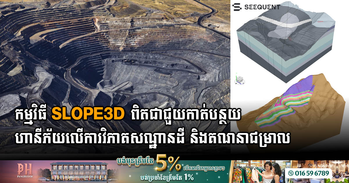
Figure 1: SLOPE3D enables the evaluation of the factor of safety and failure mechanisms of the pit slope, or analysis of previous pit wall failures with complex topography, pore-water pressures, or anisotropy.


Figure 2: SLOPE/W 2D cross-section of a benched open pit mine. Now you can expand your analysis into 3D within the same project file.


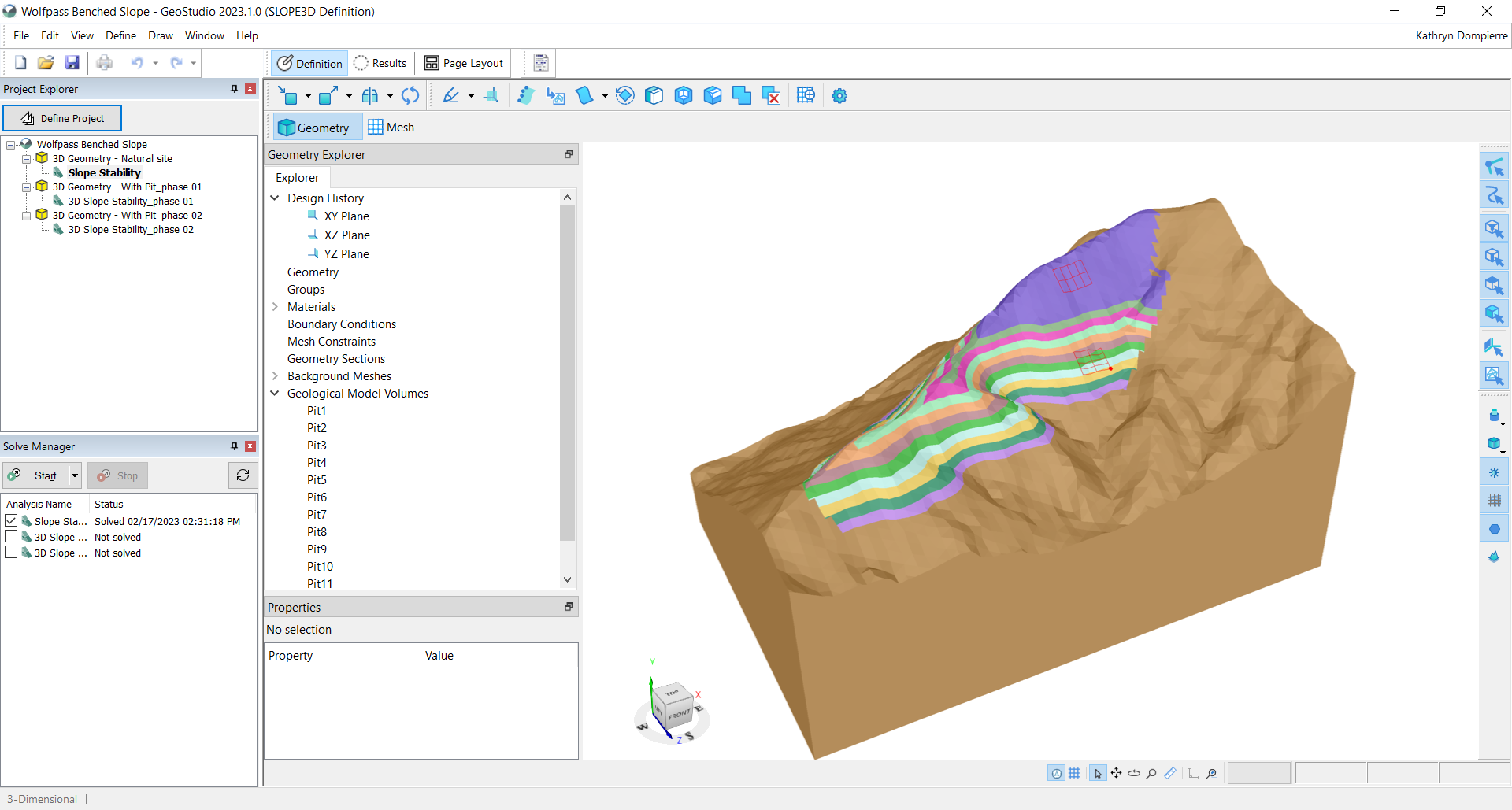
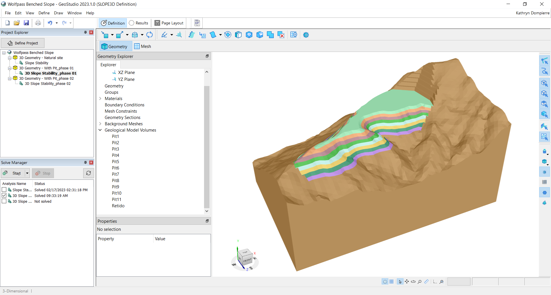
Figure 3: The same benched mine pit but now in SLOPE3D.


Figure 4: Geometry for the SLOPE3D analysis was easily created by connecting with a Leapfrog geological model.


Figure 5: SLOPE3D can also be used to investigate the stability of natural hillslopes.

Figure 6: Additional 3D geometries can be added to a project file to evaluate construction or excavation sequences.

Other use cases descriptions, for use with stock photography

  • Tailings dams: SLOPE3D allows stability assessment throughout the construction and operation of tailings storage facilities to help mitigate the risk of failure, particularly when lateral confinement is not present – for example, at the corner of tailings facilities.
  • Embankments and dams: The stability of the geotechnical structure and subsurface can be analyzed using SLOPE3D to assist geotechnical engineers and engineering geologists to design safe, dependable embankments, levees, and dams, particularly when the geometry, geology and/or groundwater flow system present challenging 3D situations.
  • Natural slopes: The potential failure of natural slopes – for example, alongside highways, rail lines, and other infrastructure – can be evaluated using SLOPE3D.

About Seequent

Seequent builds world-leading subsurface software, helping to create a better understanding of the earth to ensure a better world for all.

We are constantly evolving at the forefront of technology to transform how geo-professionals work, eliminating barriers to understanding the earth’s challenges by connecting teams with the tools they need.

Every day, our customers in over 100 countries work to develop mineral resources more sustainably, design and build better infrastructure, protect the environment, source renewable energy, and help resolve historical challenges such as groundwater contamination and ageing infrastructure.

Our integrated earth modelling, geo-data management, and team collaboration software enables our customers to see a more complete picture of the earth: because with more understanding comes better decisions – for people and the planet.

Headquartered in New Zealand with global reach, Seequent is the subsurface software company within Bentley Systems, Incorporated. Together, we are helping build a more resilient world. www.seequent.com

- Video Advertisement -

Related Post

Bentley Systems’ New Carbon Analysis Capabilities Help Reduce Infrastructure’s Carbon Footprint

Bentley makes carbon impact analysis a systematic part of the design process for new and existing infrastructure assets and simplifies embodied carbon reporting with added 3D visualisations. VANCOUVER (Bentley Systems’ Year in Infrastructure 2024) – Bentley Systems, Incorporated (Nasdaq: BSY), the infrastructure engineering software company, today announced the general availability of new Carbon Analysis capabilities […]

Indonesia Sets Sights on Becoming Southeast Asia’s Leading Electric Vehicle and Battery Hub

Indonesia has declared its ambition to become the largest electric vehicle (EV) and EV battery hub in Southeast Asia, a move highlighted by the opening of the region’s first EV battery manufacturing facility last July, according to a statement by vietnamplus, 28 October 2024. This pioneering plant, a $1.1 billion joint venture between Hyundai Motor […]

South Korea’s Gyeongbuk Technopark Sets Sights on Technology Park Collaboration in Cambodia

The Gyeongbuk Technopark Korea Innovation Center is exploring collaboration opportunities with Cambodia’s Ministry of Industry, Science, Technology, and Innovation (MISTI) to invest in a high-tech innovation hub in Cambodia, aligning with the nation’s strategic development goals in smart agriculture, health, and green technology. This promising development was discussed on 28 October 2024, during a meeting […]

Bentley Systems Partners with Google to Bring Powerful Geospatial Context and Capabilities to Infrastructure

Collaboration enables use of Google 2D, 3D geospatial content within Bentley’s applications and platforms to deliver actionable insights to infrastructure professionals VANCOUVER (Bentley Systems’ Year in Infrastructure 2024) — Bentley Systems, Incorporated (Nasdaq: BSY), the infrastructure engineering software company, today announced a strategic partnership with Google to integrate Google’s high-quality geospatial content with Bentley’s infrastructure engineering software […]

Cambodia and China Unveil Strategic Digital Infrastructure Partnership to Drive Economic Growth

The Ministry of Industry, Science, Technology, and Innovation (MISTI) of Cambodia and the China-ASEAN Information Harbor  (CAIH) have signed a pivotal Memorandum of Understanding (MoU), marking a significant advancement in digital infrastructure collaboration aimed at transforming economic development in Cambodia and the ASEAN region. The agreement, signed on 24 October 2024, is expected to enhance […]

Private Sector Prioritises 03 Key Measures to Boost Cambodia’s Automotive and Electronics Industry

Cambodia’s private sector has identified three pivotal measures from a list of 20 priorities to drive the development of the nation’s automotive and electronics industry. This decision emerged from the second meeting of the Advisory Council for the Development of the Automotive and Electronics Sector, organised by the Council for the Development of Cambodia (CDC) […]