Dataforensics unlocked incredible value for the US Army Corps of Engineers by moving subsurface data to the cloud, saving years in migration time and 62,700 work hours along the way.
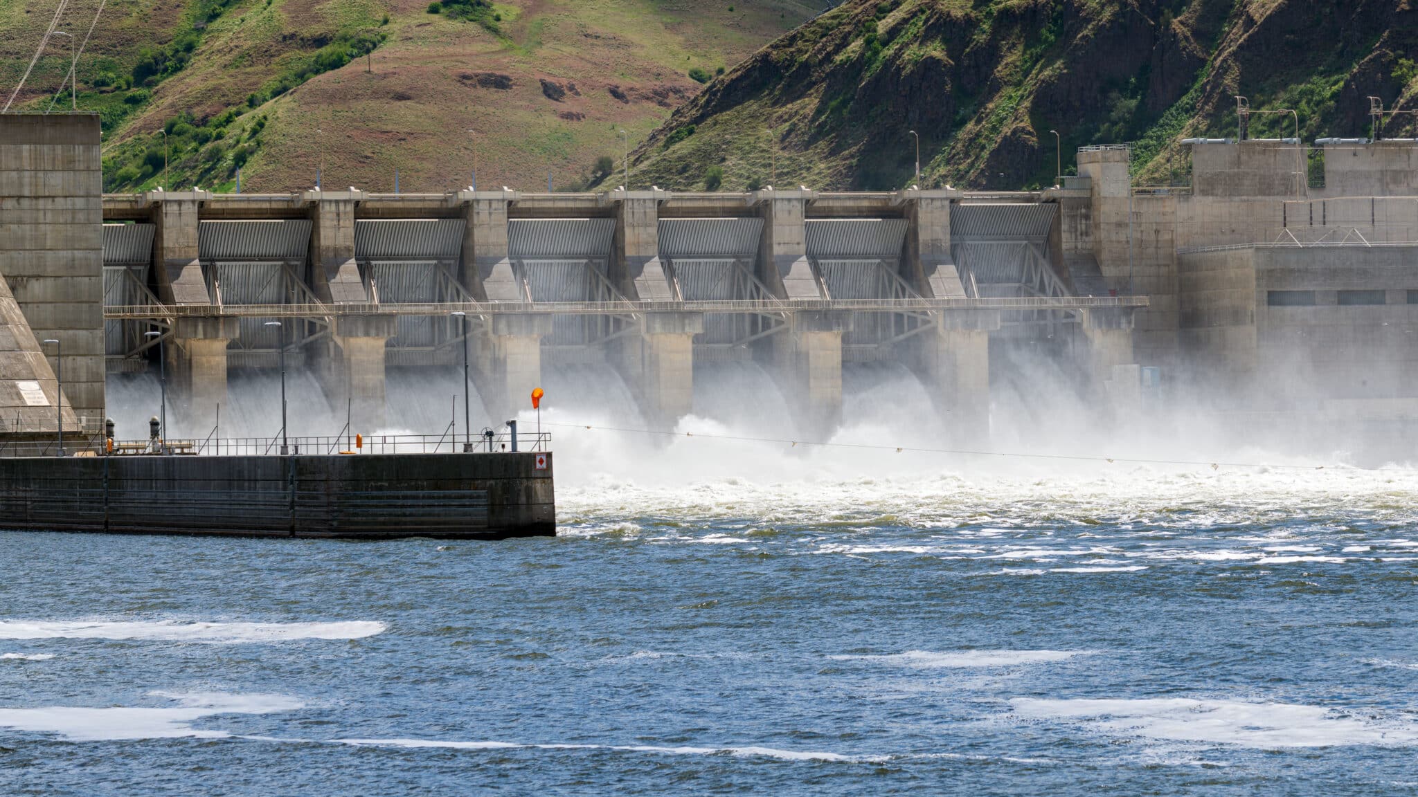
For decades, the US Army Corps of Engineers (USACE) has been gathering subsurface data essential to its operations – literally millions of linear feet of it, for thousands of projects, including dams, levees, buildings, bridges and more, scattered around the world.
Unfortunately, the number of databases in which this critical information resided was of a similar scale.
The US Army Corp of Engineers had subsurface data from thousands of projects including dams, levees, bridges and more.
The USACE had accumulated more than 500 separate and disparate database structures, leading to increasing issues with accessibility, collaboration, interoperability and workflow.
As the problems and resulting inefficiencies mounted, USACE made the strategic decision to introduce a global standardisation for its subsurface geotechnical data management and put OpenGround at the heart of its cloud-based enterprise data management.
The top priority was to compile and migrate all existing historical subsurface data, which encompassed borehole, laboratory testing, and in-situ testing. To say this was a huge undertaking would be putting it mildly.
Before the data could be loaded into OpenGround, it would first need to be cleaned and standardised, and that’s where the magnitude of the exercise became apparent. To do the job by hand would have likely taken years, if not decades. Geotechnical data management company Dataforensics were therefore recruited to develop a software programme that would automate as much of the process as possible, using the APIs for gINT (where much of the historic data resided) and OpenGround.
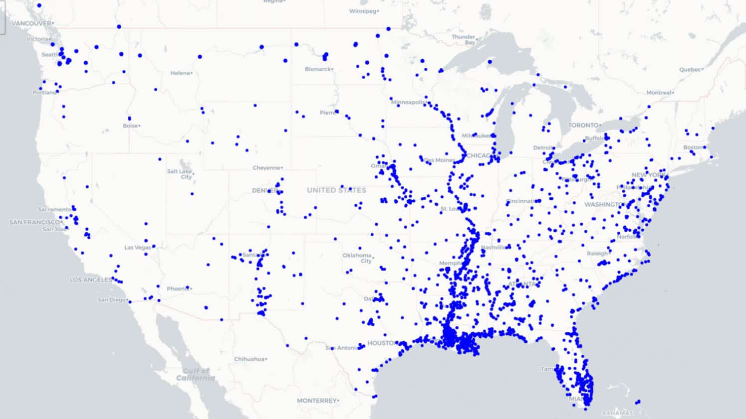
USACE map of the existing projects, approximately: 8500 projects, 200,000 locations and more than 8 million feet of drilling.
2 years
Data migration done in 2 years, 20 times faster than manual estimates.
$500M
ROI: Spend of $500k transformed USACE data into a $500m asset.
62,700
number of hours saved by going digital.
Apart from giving USACE vastly improved access to its data, and the ability to extract greater value from it, the shift to OpenGround enhanced operations in a number of other ways, such as improved collaboration between offices and contractors.
Going digital allowed USACE to unlock a tremendous asset and improve the quality of their subsurface data.
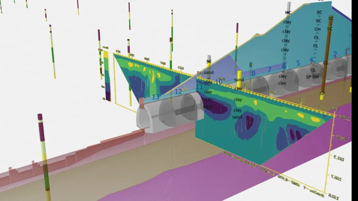
Interoperability was improved, with data now more easily integrated into software such as Civil3D, Leapfrog Works, GeoStudio and GIS platforms. In particular, the ability to import borehole information into the same platform as geophysical data (in Leapfrog) and a variety of other data (in GIS) greatly improved workflows and the ability to visualise data sets together.
Red Rock Dam project site using modern data collection methods displayed Leapfrog Works and OpenGround. The data includes geology, geographic, and geophysics data, for a comprehensive understanding of the site to address seepage concerns and design appropriate solutions.
Bringing every district under the single roof of a standardised database structure
USACE had been primarily using gINT software to manage their borehole data. However, there was no standard in place and each of the district offices was managing their information on separate servers with their own formats and reports. Shifting to an enterprise level cloud solution allowed USACE to implement a standard database structure across all districts and projects.
Hunting for anomalies and correcting typos
To improve the quality of the data, Dataforensics addressed several issues. This included correcting typographical mistakes in date values, fixing data types in scenarios where numeric values were stored in text fields in gINT, and ultimately standardising vast quantities of gINT data. Additionally, there were numerous soil properties from lab test results such as soil classifications, or interpreted results from particle size distribution tests, which were shown on gINT reports, but not actually stored as data in the database.
The successful seven-step solution was:
1. Organise the files into similar database structures that could all be migrated at the same time.
2. Generate PDF log reports for each gINT project using the gINT API.
3. Setup a data cleanup/conversion template for each set of similar database structures.
4. Perform calculations that are often reported in gINT but do not exist in the gINT database.
5. Convert to an OpenGround compatible data format.
6. Upload data to OpenGround using the OpenGround API having automatically identified the coordinate system.
7. Upload PDF documents of gINT logs to OpenGround using the OpenGround API.
All but step 3 – which required a geotechnical data specialist competent in gINT and OpenGround – were run autonomously with human oversight to check each step had been completed successfully. Left to a human without autonomous support, Dataforensics calculated that it would have taken 20 times as many hours to reach the end of the task, a saving of 67,000 hours in total.
Moving on from ‘how we’ve always done it’
Going digital and having all subsurface data in a single enterprise database (OpenGround), has helped USACE unlock the true value of a powerful asset.
The improvements in efficiency of personnel using a standardised geotechnical data management system, plus the associated cost and time savings, are substantial. USACE can collaborate more effectively across the supply chain, which saves work hours and increases productivity.
Having this information easily available in OpenGround means teams can more quickly leverage historical data to reduce risk in ongoing projects, and lessen carbon footprint by avoided re-drilling boreholes at the same locations.
USACE must also deal with critical geotechnical and geological questions that require rapid answers. The ease with which OpenGround allows the access and sharing of information has accelerated the USACE’s responses (for example, once giving within minutes the advice the Air Force required about boreholes near an area they were operating).
Standardised data from contractors means that USACE now gets all the data required for contractors to complete their investigation projects so the datasets they are receiving are more complete (e.g. they include boreholes, lab testing and in-situ testing data), available in a format they can reuse, and extract additional value from in the future.
OpenGround is speeding up the way teams can utilise data in other systems such as AutoCAD Civil 3D, Leapfrog, GeoStudio, PLAXIS, and Excel which means subsurface conditions on their sites can be evaluated more quickly, and robustly with data driven decisions made more confidently, accurately and rapidly.
Moving USACE from a paper-based to a digital agency was a complex task, but one that has left the organisation infinitely better prepared for its future.
The USACE owns and/or maintains more than:
700 dams
2000 levee systems
236 navigation lock chambers
25,000 miles of navigable waterways
Plus a range of military and environmental programs and missions that incorporate structures with life-saving implications.
With a staff of 37,000 military and civilian personnel, the USACE is one of the world’s largest public engineering, design and construction agencies.
Dataforensics was a finalist in the Bentley’s 2024 Going Digital Awards in Infrastructure awards for their work on the USACE transformation.
Emerging technologies are transforming how disaster-stricken areas rebuild, with Kentucky recently demonstrating that “digital twins” and aerial surveillance can reduce infrastructure recovery timelines from months to mere hours. Following devastating floods in 2022, the state leveraged its Bridging Kentucky initiative to bypass traditional, slow-moving survey methods. By deploying drones and 3D laser scanning, engineering teams […]
As climate-related disasters like wildfires and severe flooding become more frequent, communities across the United States are finding that their current infrastructure is struggling to keep up. Recent research suggests that moving from traditional asset management to digital one is a great move, but what is more crucial is cooperation. Duke University and industry partners […]
Digital twins, the virtual replicas of physical infrastructure, are undergoing a major transformation thanks to a new technology called Gaussian splatting. Traditionally, these models were built using “meshes,” which acted like a hollow, polygonal skin stretched over objects. While useful, meshes often struggled to capture fine details like thin wires, complex lighting, or reflective surfaces, […]
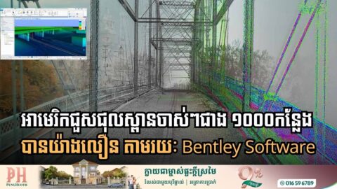
Kentucky has discovered a high-tech solution to a massive infrastructure problem, proving that fixing 1,000 aging and flood-damaged bridges doesn’t have to take a decade or cost a fortune. By using Artificial Intelligence and “Digital Twin” technology, the engineering firm Qk4 has modernized the state’s bridge program, cutting inspection times by 90% and saving taxpayers […]
Colombia’s state-owned airline, SATENA, is now using advanced engineering software to make life-saving flights safer and more frequent. While most people think of infrastructure as physical things like bridges or roads, SATENA uses a tool called Bentley MicroStation to build “invisible” roads in the sky. In the rugged mountains and dense jungles of Colombia, a […]
The city of Dublin is turning into a high-tech testing ground to solve everyday urban problems. By using “digital twins”—which are virtual, 3D copies of the physical city—leaders are finding new ways to protect residents from floods, fires, and traffic jams. This project is part of a partnership between Dublin city officials and the technology […]
This site is registered on wpml.org as a development site. Switch to a production site key to remove this banner.
 English
  ខ្មែរ
ខ្មែរ