


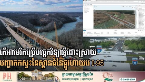
Digital Twin Tech Breaks Decades-Old Deadlock on Major I-95 Bridge Project
Engineering firm Johnson, Mirmiran & Thompson (JMT) has successfully utilized high-tech 3D modeling and connected data known as digital twin to solve congestion on I-95 crossing over the Rappahannock River in eastern Virginia, in the United States. For decades, the I-95 crossing over the Rappahannock River was defined by chronic congestion and a “not-in-my-backyard” stalemate. […]
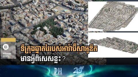
Saudi Arabia Sets Global Smart City Benchmark with “Manarah” Urban Data Platform
The Al Madinah Region Development Authority (MDA) has successfully launched the Manarah Urban Data Platform (MUDP), a state-of-the-art digital twin initiative that balances the rapid expansion goals of Saudi Vision 2030 with the preservation of ancient Islamic heritage. By utilizing a specialized suite of Bentley Systems software, the MDA has mapped 55 square kilometers of […]

Bentley Systems 2025: A Year of Infrastructure Innovation and Global Collaboration
As 2025 draws to a close, Bentley Systems is reflecting on a landmark year defined by global expansion, open-source breakthroughs, and a renewed focus on the next generation of engineers. From the streets of Philadelphia to the tech hubs of Berlin, the company’s event calendar highlighted a strategic shift toward integrated digital twins and geospatial […]
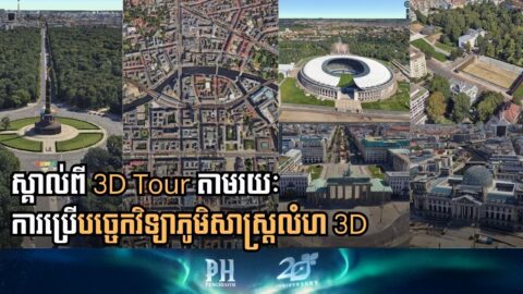
Bentley Launches Berlin 3D Tour Ahead of Tech Summit
Bentley Systems has launched a highly detailed, Cesium-powered 3D tour of Berlin in anticipation of its largest-ever in-person technical learning event, the Bentley Tech Summit 2025, set to take place in the German capital from December 9-11. The interactive, city-scale visualization invites users to explore Berlin’s iconic landmarks, celebrating the city’s history of engineering resilience […]
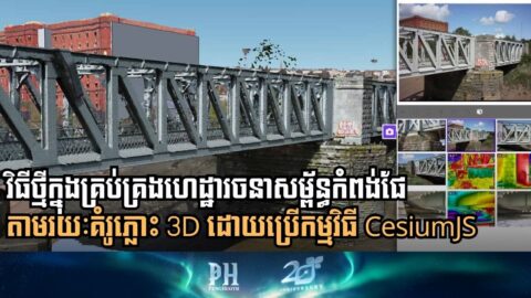
Bristol Harbor Goes Digital: 3D Twin Revolutionizes Asset Management and Safety
Bristol City Council has successfully completed a pioneering project to digitally future-proof its vital harbor infrastructure, embracing advanced remote sensing and 3D visualization. Partnering with Mott MacDonald, the city has created a sophisticated “digital twin” of its 21-kilometer harbor, dramatically overhauling how it manages over 300 above and below-water assets. Tired of costly, dangerous, and […]
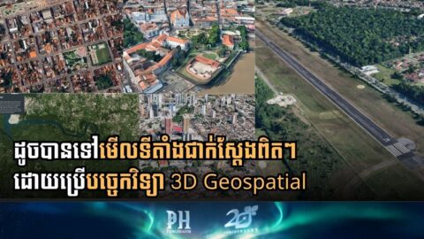
Clicking a Button to Fight Climate Change: Bentley’s 3D Geospatial Tech Goes to COP30
What if we could inspect a remote wildfire, survey a flood zone, or model a massive urban project from a desktop? According to global engineering software leader Bentley Systems, this is no longer a hypothetical question—it’s the new front line in the fight against climate change. As the city of Belém prepares to host the […]