 English
  ខ្មែរ
ខ្មែរ 


New Urban Planning Agreement to Extend R4 Road and Ease Traffic Congestion in Phnom Penh
- 29 June 2026
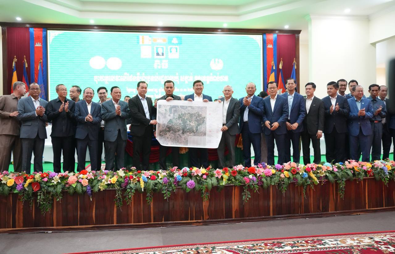
In a significant breakthrough for urban mobility in the capital, an agreement has been reached to open a new road alignment connecting the Boeung Kak area directly to Preah Monivong Boulevard. This initiative, officially announced by the Ministry of Land Management, Urban Planning and Construction on June 19, 2026, aims to significantly alleviate traffic congestion […]

Government Set to Transform Kep and Sihanoukville Islands into Vibrant Economic Hubs
- 4 April 2026
High-level inter-ministerial delegation concludes field inspections to finalize development master plans for the Kingdom’s coastal jewels In a strategic push to unlock the economic potential of Cambodia’s coastline, the Royal Government has set a clear course for the revitalization and development of islands across Kep and Sihanoukville provinces. This initiative reached a significant milestone following […]

Bentley Systems Partners with Google to Bring Powerful Geospatial Context and Capabilities to Infrastructure
- 30 October 2024
Collaboration enables use of Google 2D, 3D geospatial content within Bentley’s applications and platforms to deliver actionable insights to infrastructure professionals VANCOUVER (Bentley Systems’ Year in Infrastructure 2024) — Bentley Systems, Incorporated (Nasdaq: BSY), the infrastructure engineering software company, today announced a strategic partnership with Google to integrate Google’s high-quality geospatial content with Bentley’s infrastructure engineering software […]

Siem Reap, JICA Accelerate Smart City Project Masterplan Progress
- 8 December 2021
The Siem Reap Provincial Administration and the Japan International Cooperation Agency (JICA) have discussed the progress of the smart city master plan, to accelerate implementation. The discussion focusing on technical cooperation was chaired by Siem Reap Governor HE Tea Seiha and JICA (Cambodia) Director Kamei Haruko. In the decision, the two parties also agreed to […]