


Tech Pivot Saves Germany’s First All-Digital Highway Project
A landmark infrastructure project in Germany is back on track and shattering efficiency records after a critical mid-course correction in its digital strategy. Viscan GmbH, the company tasked with creating a “digital twin” for the B29 highway expansion in Baden-Württemberg, successfully rescued the project from technical failure by overhauling its data processing systems. The ambitious […]

The Quiet Revolution: How AI is Reshaping America’s Highways
The US Department of Transportation (DOTs) is now utilizing AI to maintain roads and highways, as Alabama has become the latest state to bet its infrastructure budget on AI. For years, the Alabama Department of Transportation (ALDOT) relied on “performance-based budgeting,” a system designed to fund projects based on actual road needs rather than historical precedent. […]

ALDOT Integrates Bentley’s AI to Refine Performance-Based Highway Budgeting
Alabama Utilizes Bentley Tech to strengthen data-driven maintenance planning The Alabama Department of Transportation (ALDOT) is enhancing its long-standing performance-based budgeting model by integrating Blyncsy, an AI-powered solution from Bentley Systems. For more than 15 years, ALDOT has led the way in using data to drive financial decisions, but the manual collection of condition data […]

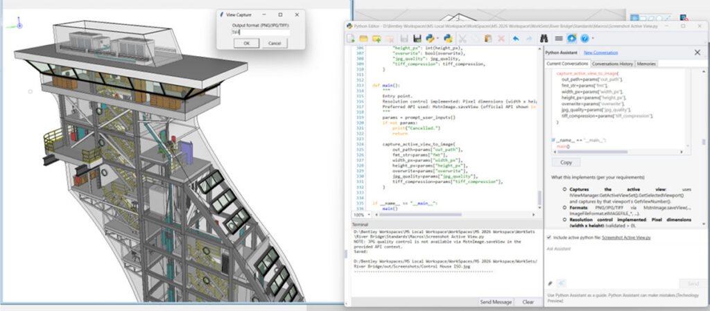
Bentley Systems Breaks Bottlenecks with New iTwin Capture Workflow
Bentley Systems is redefining the digital twin landscape by launching a more flexible, scalable approach to reality modeling. The new iTwin Capture workflow aims to eliminate the traditional “hardware wall” and high upfront costs that have long hindered engineers and urban planners. For years, infrastructure professionals have struggled with massive datasets—from LiDAR point clouds to […]

Europe’s Aging Power Grid Faces Digital “Makeover” to Meet 2030 Climate Goals
With many distribution grids expected to exceed their 40-year lifespan by 2030, EU policymakers and industry leaders are pivoting toward a “digital-first” strategy to prevent the system from buckling under the pressure of the green transition. The EU electricity infrastructure currently spans over a million kilometers, serving 600 million customers. To meet climate targets, the […]
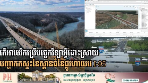
Digital Twin Tech Breaks Decades-Old Deadlock on Major I-95 Bridge Project
Engineering firm Johnson, Mirmiran & Thompson (JMT) has successfully utilized high-tech 3D modeling and connected data known as digital twin to solve congestion on I-95 crossing over the Rappahannock River in eastern Virginia, in the United States. For decades, the I-95 crossing over the Rappahannock River was defined by chronic congestion and a “not-in-my-backyard” stalemate. […]