Seequent unveils SLOPE3D: Advanced stability analysis tool to help engineers design safer slopes

SLOPE3D extends capabilities of GeoStudio’s trusted 2D SLOPE/W product into 3D, significantly enhancing stability assessments for slopes in the mining and civil industries.

Seequent, The Bentley Subsurface Company, announced the release of SLOPE3D, an advanced slope stability analysis tool that empowers geotechnical engineers and engineering geologists to design safer slopes.

Building on the capabilities of GeoStudio’s trusted 2D SLOPE/W product, SLOPE3D is an intuitive limit equilibrium solution for analyzing rock and soil slopes in mining and civil projects – for example, hillslopes, open pit mines, and engineered structures such as dams and levees.

Chris Kelln, Director, Technical Solutions for GeoStudio, said, “SLOPE3D combines the most up-to-date research on 3D slope analysis techniques with the capabilities in SLOPE/W, a trusted tool for assessing 2D slope stability for over 30 years, providing a practical approach for capturing slope failure mechanisms for simple to complex geotechnical models.”

“Ensuring the safety and reliability of engineered projects is at the heart of geotechnical engineering,” Kelln added. “We specifically designed SLOPE3D to empower geotechnical and geological engineers to make confident decisions, improve safety, reduce project risks and costs, and ultimately design better infrastructure.”

GeoStudio’s powerful and easy-to-use interface provides a unique modelling and analysis experience. Multiple 3D geometries and analyses can be added to a single project and solved simultaneously. Geo-professionals can include SLOPE3D analyses in existing 2D stability projects for efficient results comparison.

SLOPE3D connects directly with Seequent’s geological modelling software, Leapfrog, via Seequent Central, and integrates with GeoStudio’s SEEP3D. This creates a seamless workflow with smooth data exchange and simpler data management to improve project accuracy and outcomes.

SLOPE3D can be purchased now from Seequent. See the new SLOPE3D product page for more information, release announcement video, and a free trial. SLOPE3D is part of the GeoStudio 2023 release.

ENDS

Notes to Editors

Download high resolution images, and product video


Figure 1: SLOPE3D enables the evaluation of the factor of safety and failure mechanisms of the pit slope, or analysis of previous pit wall failures with complex topography, pore-water pressures, or anisotropy.


Figure 2: SLOPE/W 2D cross-section of a benched open pit mine. Now you can expand your analysis into 3D within the same project file.


Figure 3: The same benched mine pit but now in SLOPE3D.


Figure 4: Geometry for the SLOPE3D analysis was easily created by connecting with a Leapfrog geological model.


Figure 5: SLOPE3D can also be used to investigate the stability of natural hillslopes.

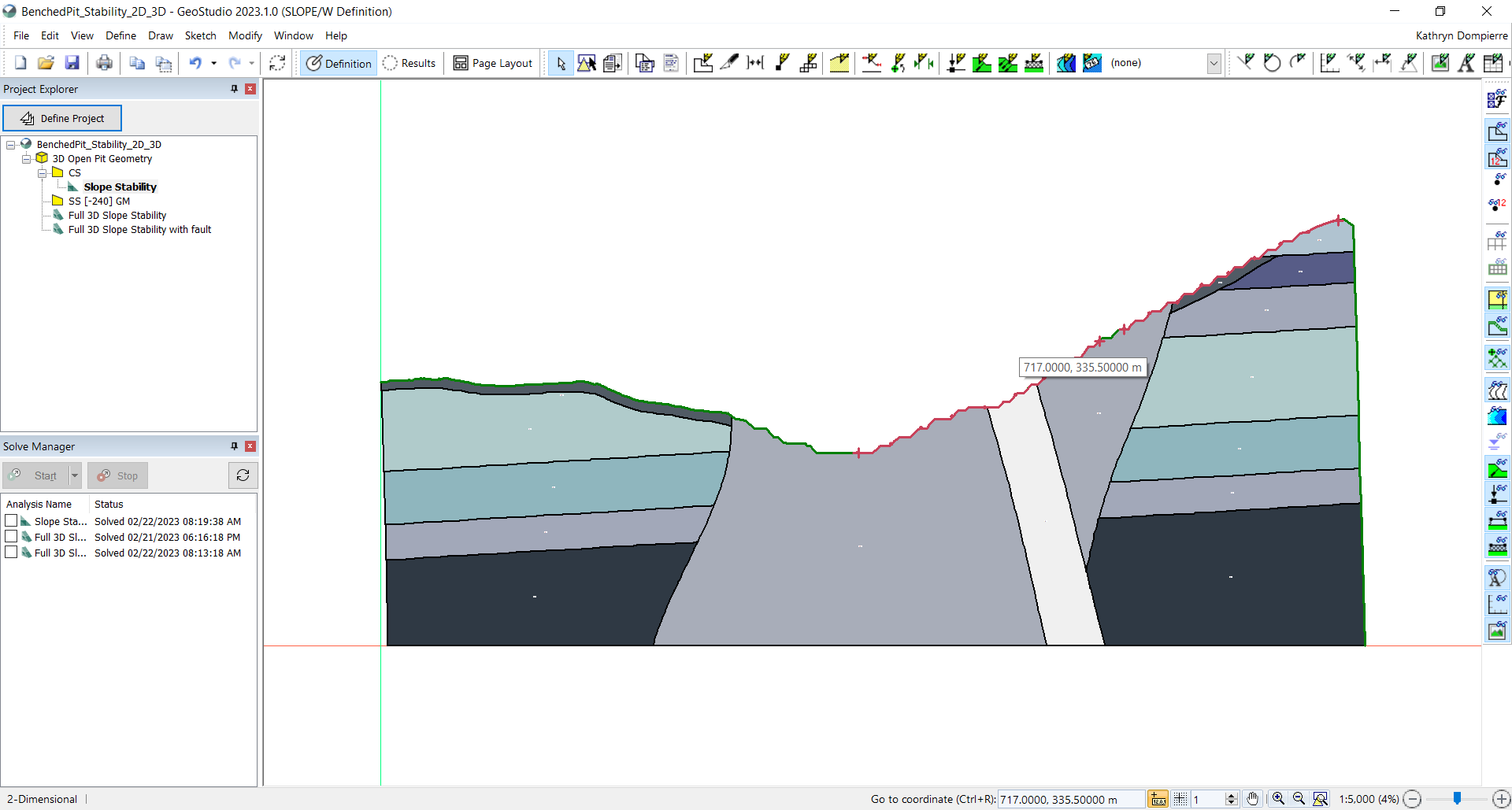
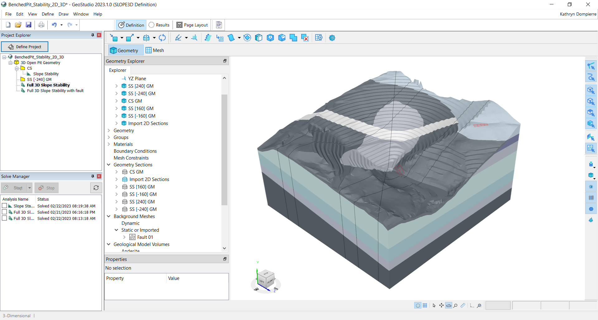
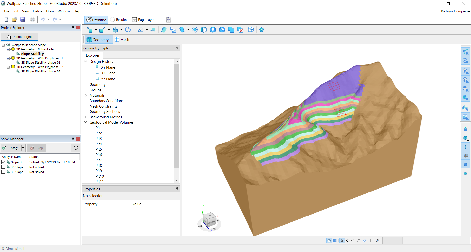
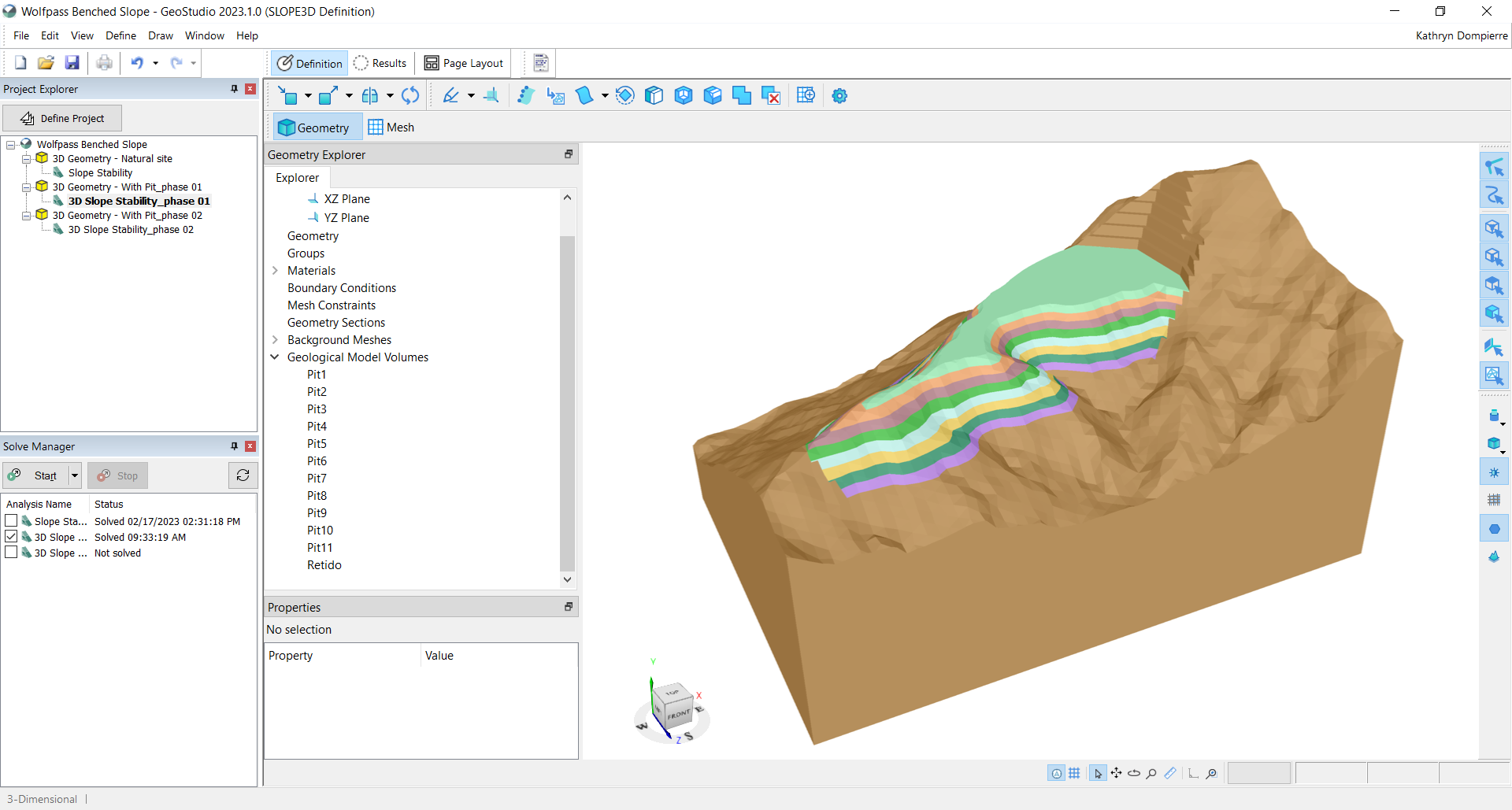
Figure 6: Additional 3D geometries can be added to a project file to evaluate construction or excavation sequences.

Other use cases descriptions, for use with stock photography

  • Tailings dams: SLOPE3D allows stability assessment throughout the construction and operation of tailings storage facilities to help mitigate the risk of failure, particularly when lateral confinement is not present – for example, at the corner of tailings facilities.
  • Embankments and dams: The stability of the geotechnical structure and subsurface can be analyzed using SLOPE3D to assist geotechnical engineers and engineering geologists to design safe, dependable embankments, levees, and dams, particularly when the geometry, geology and/or groundwater flow system present challenging 3D situations.
  • Natural slopes: The potential failure of natural slopes – for example, alongside highways, rail lines, and other infrastructure – can be evaluated using SLOPE3D.

About Seequent

Seequent builds world-leading subsurface software, helping to create a better understanding of the earth to ensure a better world for all.

We are constantly evolving at the forefront of technology to transform how geo-professionals work, eliminating barriers to understanding the earth’s challenges by connecting teams with the tools they need.

Every day, our customers in over 100 countries work to develop mineral resources more sustainably, design and build better infrastructure, protect the environment, source renewable energy, and help resolve historical challenges such as groundwater contamination and ageing infrastructure.

Our integrated earth modelling, geo-data management, and team collaboration software enables our customers to see a more complete picture of the earth: because with more understanding comes better decisions – for people and the planet.

Headquartered in New Zealand with global reach, Seequent is the subsurface software company within Bentley Systems, Incorporated. Together, we are helping build a more resilient world. www.seequent.com

- Video Advertisement -

Related Post

Digital Safety Nets — How Software is Preventing Workplace Disasters

In the high-stakes world of industrial maintenance, a split-second decision can lead to a catastrophic “arc flash”—an electrical explosion of intense heat and pressure. Today, we look at how manufacturing leaders are turning to advanced modeling software, specifically EasyPower, to transform these life-threatening risks into manageable business data. A routine inspection at a local manufacturing […]

Bentley’s SACS Software Saves Millions for India’s Offshore Energy Sector

The Oil & Natural Gas Corporation (ONGC) has utilized Bentley’s SACS software to digitally assess 18 unmanned wellhead jacket platforms off India’s western coast, aiming at achieving energy independence through modernization. These existing structures required modifications, such as adding clamp-on conductors, to enhance oil production. However, the platforms first had to be tested against much […]

Cambodia and China Partner to Advance Satellite Imagery Technology for Environmental Modernization

Strategic MoU aims to build ecological safety and a green future through enhanced data management and precision monitoring Cambodia and China have committed to a new era of technical cooperation aimed at modernizing the Kingdom’s environmental sector through advanced satellite imagery technology. The partnership was formalized through a Memorandum of Understanding (MoU) signed on March […]

Digital Twins and Drones Slashing Bridge Recovery Times in Kentucky

Emerging technologies are transforming how disaster-stricken areas rebuild, with Kentucky recently demonstrating that “digital twins” and aerial surveillance can reduce infrastructure recovery timelines from months to mere hours. Following devastating floods in 2022, the state leveraged its Bridging Kentucky initiative to bypass traditional, slow-moving survey methods. By deploying drones and 3D laser scanning, engineering teams […]

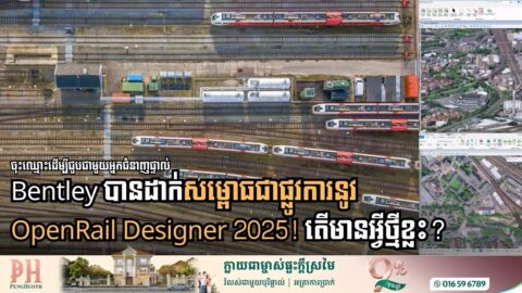
OpenRail Designer 2025: Redefining Efficiency for Global Rail Infrastructure

Bentley Systems has officially launched OpenRail Designer 2025, a major update designed to eliminate the manual bottlenecks that have long challenged rail engineers. By focusing on advanced automation, data integrity, and high-fidelity geospatial integration, this release transforms how complex rail networks—from routine maintenance to high-speed megaprojects—are designed and managed. As global demand for resilient infrastructure […]

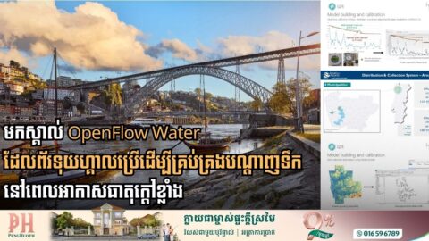
How Portugal Uses Digital Tools to Manage Water Network During Heat Waves

As summer temperatures in northern Portugal consistently climb past 38°C, regional water utility Águas do Norte has successfully pivoted from reactive repairs to proactive management by leveraging Bentley Systems’ OpenFlows Water solution. Serving nearly 2 million residents across 63 municipalities, the utility faced recurring crises where extreme heat caused water tanks to hit critical lows, […]