 English
 ខ្មែរ



Bentley announces the Bentley Technology Summit to be held in Toronto, Canada
- 1 November 2026

As urbanization accelerates and the demands on global infrastructure reach unprecedented heights, the industry stands at a major turning point. From managing complex subterranean geology for major metropolitan transit lines—like Vienna’s ambitious metro expansion using advanced 3D subsurface models—to navigating new paradigms in artificial intelligence and connected data, modern civil engineering is undergoing a massive […]

How a 3D Underground Model is Shaping Vienna’s Transit Future
- 31 October 2026
As Vienna’s population continues to surge and tourism hits record-breaking highs, the Austrian capital is looking downward to secure its future. The city is currently boring a brand-new metro line through some of the trickiest, most varied geological terrain in Europe—guided by an innovative 3D subsurface model that began, fittingly, on a rooftop. A Legacy […]

Bentley’s Year in Infrastructure Awards Opens in Singapore With a New Format, New Host, and 36 Finalists
- 25 October 2026
The people shaping the world’s infrastructure deserve an experience as extraordinary as the work they do. This year, Bentley built one. Bentley’s Year in Infrastructure Awards opened in Singapore with a new look. Now in its 22nd year, the event often called the “Oscars of Infrastructure” has a new host, a new keynote format, and […]

PLAXIS 2D Helps Model Madrid’s Traditional Tunnel Construction Method
- 24 October 2026
Engineers have developed a methodology using PLAXIS 2D to simulate tunnels built with the Traditional Method of Madrid (TMM), offering a faster alternative to complex three-dimensional analyses. Used in the Madrid Metro since 1917, the TMM divides tunnel excavation into small sections, typically less than 5 square meters. Each section is temporarily supported with timber […]

How Bentley Software Is Helping Keep Mumbai’s Massive Sea Bridge on Track
- 17 October 2026
Mumbai’s Versova-Bandra Sea Link (VBSL), a 17.17-kilometer, eight-lane bridge set to become India’s second-longest, is being built with the help of digital project management software designed to keep a hugely complex construction effort organized and on schedule. Once finished, the bridge will connect Versova to Bandra and is expected to cut commute times sharply for […]
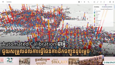
Automated Calibration Streamlines Travel Demand Modeling
- 16 October 2026
Automated calibration is helping transportation planners make travel demand modeling faster, more efficient and responsive to changing travel patterns. Traditionally, calibrating travel demand models required months of manual adjustments to ensure model results matched real-world data such as traffic counts, transit ridership and household travel surveys. Automated calibration simplifies the process by using optimization algorithms […]